Perth – Carsonby

perthmap

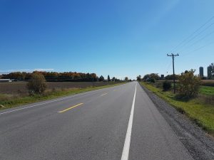
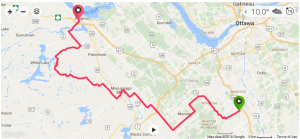
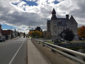
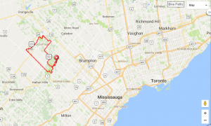
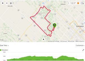
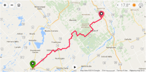
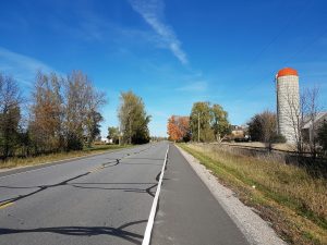
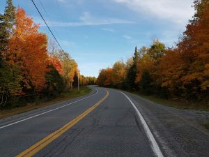
My younger son had a hockey game in Perth yesterday so I naturally decided to explore some bike routes home while my wife drove back. I originally had a route plotted through GPSies but on the drive down I noticed the final bit of Hwy 10 from Franktown to Perth had a nice shoulder. So I called an audible and modified my plan to start with this quicker leg instead of a more southerly pre-planned route. My son’s game didn’t end until 3:30PM and sunset comes quickly in October so I didn’t have much time for lengthy/slower routes.

hwy10

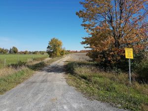
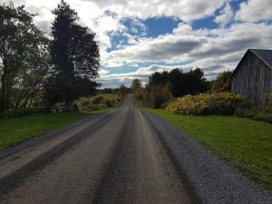
After about 20km I pulled off of Hwy 10 and picked up some local country roads & gravel. The plan was to take Pinery Road for the majority of the distance between Hwy 15 and Dwyer Hill Rd.

countryrd

fallgravel

chipseal

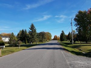
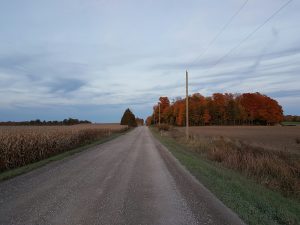
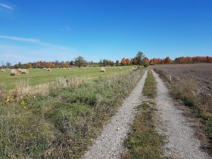
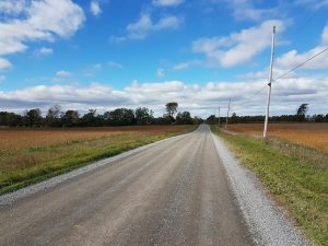
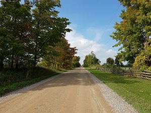
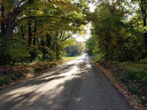
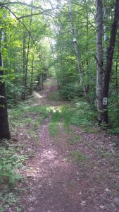
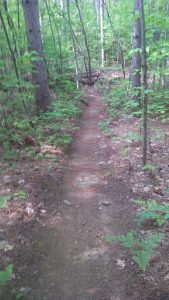
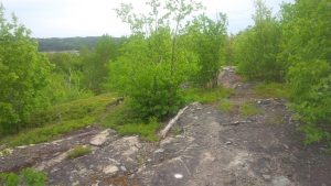
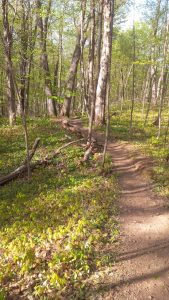
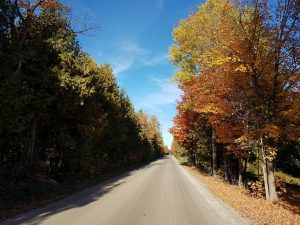
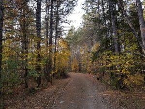
Eventually I made it onto Pinery Road which started with nice hardwood and slowly changed to more spare terrain that is common around Marlborough Forest.

pineryrd

pineryrd2

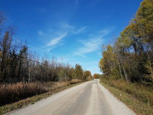
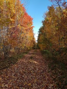
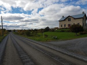
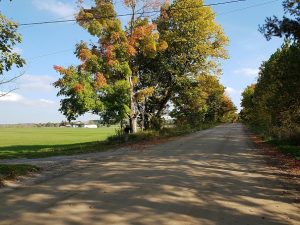
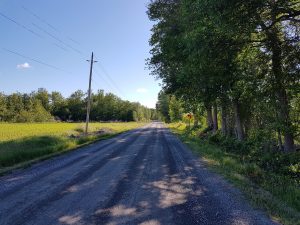
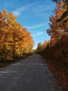
Just past the 1/2 way mark I was on Dwyer Hill Rd and took it south for a couple of km to jump into Marlborough Forest. Unfortunately there’s no shoulder here so traffic can come buzzin’ by pretty quickly…

dywerhillrd

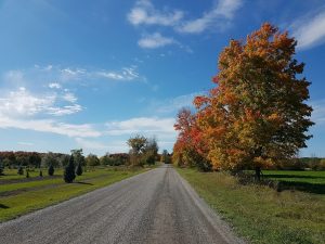
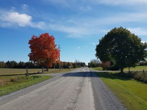
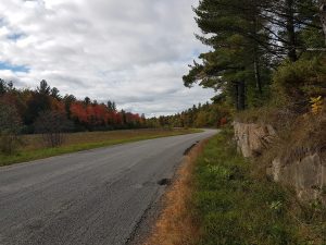
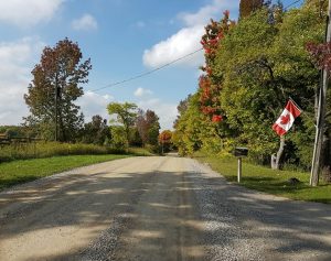
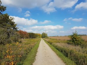
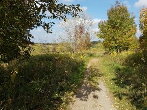
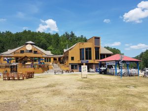
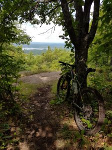
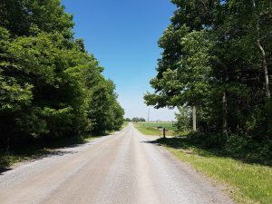
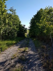
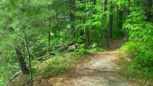
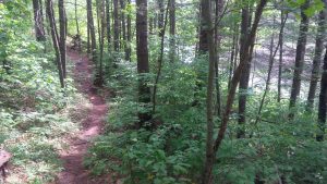
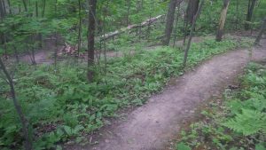
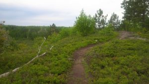
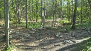
Marlbrough Forest is an interesting region with lots of history of Irish settlement in the early 1800s. Interestingly and unbeknownst to me at the time, this picture was taken a short distance from an old pioneer cemetery used from ~1820s up to 1860s. Supposedly this region is haunted.

marlboroughforest3

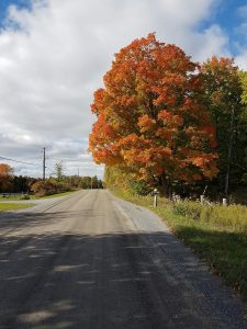
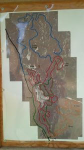
This is my second outing into Marlborough in the last month, after 10+ years of ignoring it. I’ve revisited the area trying to find a rideable East-West route that’s further north of Paden Road. The next feasible northern option (read: quiet gravel/paved road or paved shoulder) is Copeland Road just north of Hwy 10/Franktown Road but it doesn’t go as far East as Richmond.

marlboroughforest

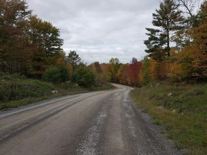
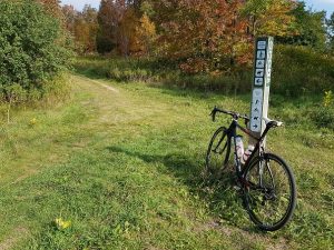
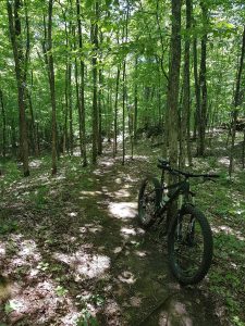
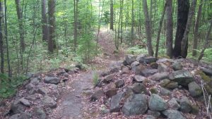
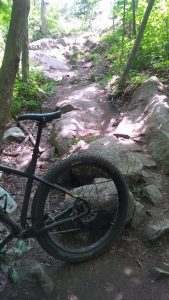
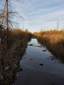
Unfortunately, I was quickly reminded why I dropped it from consideration years ago. Much of it is too rocky/muddy for high speed travel on a 35c gravel tire (down to 6kph in areas). The region also tends to be quite seasonal with insane bugs in the spring/summer due to the plentiful wetlands, and in the fall there’s lots of ‘relaxed’ hunting.

marlboroughforest2

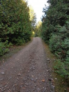
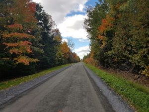
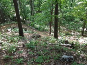
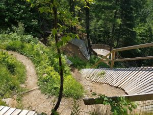
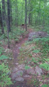
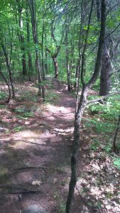
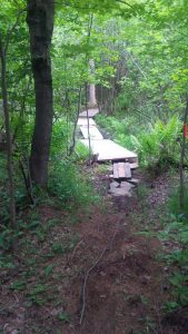
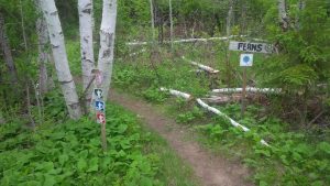
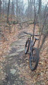
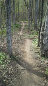
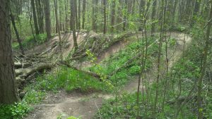
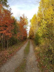
The final nail in the coffin was when I realized that a middle ~1km section of Klondike Road within the Forest is still too rough & wet for reliable biking, or even dry hike-a-bike for that matter.

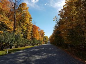
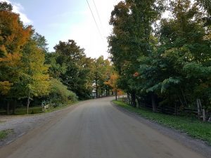
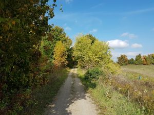
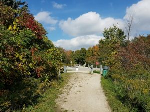
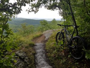
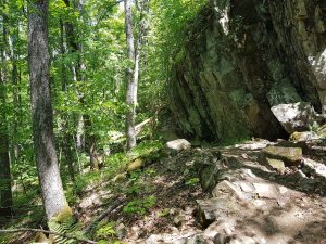
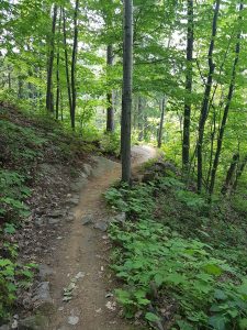
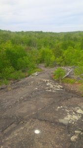
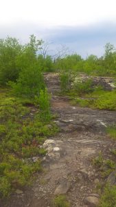
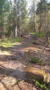
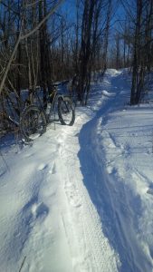
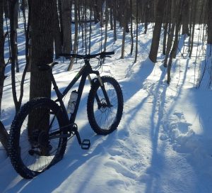
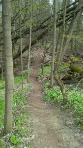
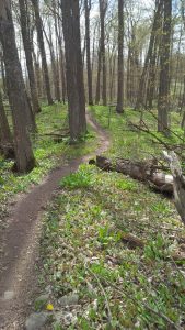
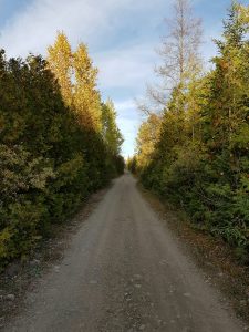
The left picture shows the western portion of Klondike Road within the Forest that is passable. The right picture is 2-3 km further east on Klondike. Note that this it the best it gets, in the spring the water is 1-2 feet higher.

klondikedry klondikewet

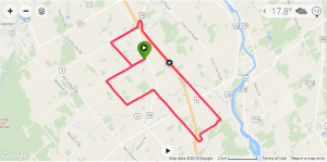
After ~2:40 ride time and 70.5km later I made it home – just before dark.

finalstretch

Carsonby Lunch Loop

I previously mentioned how lucky I am to have an abundance of gravel outside my door. When working from home I have a favorite loop which at 28.5kph long I can get done within 1 hour.

llmap

I enjoy this loop because it has the best scenery, twisting routes, and a little of everything surface wise. It’s also a safe route with almost 100% on quiet roads or buffered with a wide shoulder.

It starts with a couple of km of gravel.

gravel_start

Followed by a couple of paved km which includes a nice shoulder.

paved-start

Next I turn onto an unmaintained/farming road.

um_road1

This is my preferred part for testing tires/pressures. There’s quite a few larger rocks along this 2-3km section.

um_road2

As pretty as the leaves are, they can be treacherous – in this case hiding the aforementioned rocks…

um_road3

After a bit I pop onto freshly chip sealed road. This section has a few rolling hills and is a great way to get the HR up when out of the saddle.

chipseal

The final leg is a nice gravel drag strip. It’s probably 10km long and dead straight. If the legs are feeling strong it’s a perfect section to include 10-15min of tempo.

gravel

North Gower – Almonte – Pakenham – Arnprior, Auntie’s Route

Thanksgiving is upon us in Canada and despite being a long weekend there’s always the need to balance extra ride time with visiting family. Rather than sit in a car for 1 hour from North Gower to my sister-in-law’s place in Arnprior, I’ve been riding the route. Killing two birds (travel & workout) with one stone.

almonte3

I used to stick to Dwyer Hill Road which has a nice paved shoulder from Burritts Rapids up to the Carleton Place exit (Hwy 7) then deal with 100kph drivers buzzing me all the way up to Arnprior. Eventually I decided to investigate alternate routes and discovered Bellamy Road last year which goes up & over the Lanark Highlands from behind Pakenham out to Arnprior.

I’ve been playing with GPSies site lately as it allows me to create routes and upload into my Garmin 200. Here’s a link Auntie’s in Arnprior route.

map

Riding in the fall is always nice, but as the map shows, I rode predominantly North West which is typically into the prevailing West->East winds in our region. This meant 4.5hours (and brutally slow 24.5kph) of persistent 20-25kph headwinds. It was especially bad during the first 1/2 of the route which is more flat & open.

almonte2

Almonte is about the 1/2 way point and a good time to refill water & grab some calories.

almonte

From this point you enter Lanark Highlands and it’s really nice rolling terrain right through to Arnprior.

pakenham2

There’s even some really nice country homes to admire.

pakenham3

Continuing North West you end up behind Pakenham and pass Fulton’s Pancake House. Amazing color in the trees.

pakenham

Shortly after Fulton’s you start Bellamy Road. It’s a chipseal/gravel split that’s quite quiet. You really get the feel of crossing up and over the Highlands, even the trees seem to get a little smaller and more sparse.

bellamyrd2

bellamyrd

Eventually you pop out onto a freshly paved chipseal road with a nice little shoulder as you enjoy that hard-earned elevation back down to the Ottawa River.

arnprior1

In future I’ll try veering off of Hwy 20 sooner and take ‘Robertson Line’ or ‘Concession 8 / Mountain View Road’ north to Hwy 2 as it appears to also be repaved with a nice bike-friendly shoulder (which Hwy 20 does NOT have and can be busy).

All in all a terrific 100+km ride despite the non-stop headwind and <10c temps.


GTA – Erin gravel loop

I’ve travelled to the GTA/Toronto area for years and each trip I hated the fact that there was little that was good to ride in the city which meant I was off my bike for x days. There are limited options within the city (read: shouldered/bike lane road) but it’s still a sketchy undertaking with the local ‘drivers’, there are frequent interruptions by the MANY traffic lights, and it is often only an out & back route.

One option is to drive out to Milton and ride North within the Halton/Guelph region, but that requires fighting the never-ending 401 West traffic which equates to a ~45+min drive before I can even start.

All that changed when I happened to find some great GPS loops posted by ‘eaves’ on RideWithGPS.com. One such loop is the CX-TC-ERIN 60 Gravel route.

gta_map

While it certainly helped that the last few rides have been perfect fall weather with blue sky and maples showing off fall colors, this is one awesome loop which can stand proud regardless of weather!

gta2

Parking is only about a 20min drive north on Mississauga Road from the 407. It’s a nice quiet spot at the intersection of Heritage Rd and Hwy 9/King Street. Right away you’re thrown on tranquil chip seal country roads with lots of bends, elevation, and narrow bridges.

Soon you’re on some pristine gravel.

gta11

gta12

gta4

After a ~20km trip north you’re routed onto the Elora Cataract Trail which takes you ~10km East.

gta14

gta10

While it’s hard to build a lot of tempo on this section due to local walkers and a few road crossings, it’s a super nice trail to cruise & enjoy the scenery.

gta13

At the end of Elora Cataract Trail you’re directed into the ‘Forks of Credit’ Provincial Park which is park of the Bruce Trail.

gta9

gta8

Eventually the route pops you back onto gravel and an awesome grunt up to the ‘The Grange Equestian Community’ (~450feet over 2.2km).

gta5

gta6

The route ends with a little trip down the Caledon Trail which can be further leveraged on another loop from eaves called CX-TC-ERIN+ 56.

gta1

Final stats are 59km, ~1300M/3700 feet of elevation, 2-2.5 hrs ride time. It’s a perfect ride for a CX/gravel bike with 35mm tires (Schwalbe G-One)

mapelevation


Mont Ste Marie & VeloMSM – Eastern Ontario’s latest MTB playground

In the last ~7 years a new option for Mountain Biking has popped up in Eastern Ontario, Mont Ste Marie. In less than a decade this area has turned into a MTB hot spot with $100+K invested and thousands of visitors per year. Their annual MSM Velo Fest is into it’s 3rd year now and the events/attendance of bike companies is quickly becoming one of the largest in Eastern Canada.

chalet

Origins

In a rare exception, I will allow some personal elements to be included in  this blog. What makes this area more satisfying to me than others is that it all started as a pet project of mine when I owned a chalet near the ski hill. That first trail (now Hotel & California) was my first attempt at building a trail. I killed myself that summer to get a trail running high along a ridge of the local lake. When it was all said & done I dragged out my clunky GPS and was horrified to learn it was only 1.1km round trip! That was the first slap of reality of just how much work it takes to build trails. Ultimately, I didn’t do too bad, it’s still in good condition 7+ years later.

msm1

Pilsner

After a year or two off, some local friends and I decided to build a loop leveraging ‘Radar Road’ (gravel road that climbs from bottom to one of the two peaks). From the top of Radar Road (Cheval Blanc peak) we built ‘Pilsner‘ which connected the two peaks of the resort. It was a grunt but we managed to complete the 2.3km connection to the 2nd peak (Vanier) in just 1 summer. One of the trail highlights is ‘Pilsner Point’ which shows off Hectares of untouched Quebec wilderness from a view-point several hundred feet up. It reminds me of North Carolina, and to a lesser extend Albion Hills, in many ways.

pilsnerpoint_1 pilsnerpoint_2

Lager

To complete the loop we needed a trail from the top of Vanier back down to start of Radar Road. Once again we completed it in one summer but it took even more time & help. We had to do a LOT of scouting to ‘safely’ descend roughly 1000 feet in just 2 km. It took a lot of rock movement to build the catwalks & switchbacks but it was eventually complete. Following the beer theme, we named it Lager. It too included an amazing view which we call Lager Lookout.

lagerlookout_1

Moving Forward

Near the end of Lager completion we learned of another MTB crew who had recently purchased recreational property in the area and were interested in completing a loop around the lake, leveraging Hotel & California. We offered out assistance and from there a club was formed (VeloMSM) and the rest is history.

thunderbird

There is now a total of 38km of trails and rapidly expanding every year with a total of 8,400 feet of descending.

ttop_4

There are some insanse climbing trails like Tower of Power, and wicked ‘Flow’ trails like Hollywood/Lug Tread/Growler.

ttop_2

If you’re ever looking for an amazing place to ride, this is it. It’s about 1hr drive north of Ottawa and there’s lots of condos to rent and camping at the lake.

ttop_3 ttop_5


North Gower – Gravel

Despite the postings to date, OttawaVelo isn’t all about MTBing. In fact about 95% of my annual KMs are on gravel. I love the stuff and can see myself riding it years after I retire from technical single track.

Somewhat ironically I used to be envious of those riders who lived a short ride away from some huge MTB singletrack network (ie: Colorado). Actually I still am, but I’ve come to realize that where I live offers some pretty damn beautiful gravel options right out my door that I enjoy a good 4-5 times a week.

RedlineOld

So what’s the gravel like around North Gower? Maybe the best way to answer that question is to explain my gravel ride. It’s a 2015 Redline Conquest Team. If stiff, it’s low, and meant for tempo speed. I run mini-V brakes, 11-23 cassette (1×10), Pacenti SL23 rims on tubeless Schwalbe G-One 35mm (awesome!) tires. She’s fast on smooth gravel and respectable on pavement.

NorthGower_2

What that means is that this region has little elevation (hence the tight cassette and non disc), and the gravel is typically fast (hence the 35c tires). This stuff won’t beat up yours legs anywhere near as quickly as Lanark Highlands/Gats (future postings).

NorthGower_FarmRoads

There are a few chunkier farming access roads but they’re pretty short.

NorthGower_1

If you’re visiting the area here’s just one option (too lazy to post a GPS file… some day I’ll get to it):

Parking just off 416, ~65km route:

  1. Take the Bankfield exit off of 416 (exit #57 I believe). Park & ride on the North West corner.
  2. Take William McEwen Drive south, left on Century Road West
  3. Take a quick hop over the 416 via Prince of Wales North
  4. Take 2nd Line Road South for a good while ’til T junction
  5. Right/East on Lockhead road.
  6. Left/South on 3rd Line Road South
  7. Right/West on Hwy 13, continue straight on Dilworth at the 4th Line Road junction.
  8. Right/North on McCordick
    • ride extention~40-50km, go left to Hwy #5, then West & over the river towards Kemptville. First right is River Road, follow the river to Burritt’s Rapids. Admire the lock/history then go north through village, a quick left/right up Dwyer Hill Road. First gravel right is Paden which is same road (opposite direction) as #11. #12 will be Left/North onto Paden.
  9. Left/West on Cowell
    • bail-out option, ignore #9 and continue north to #17 below
  10. Left/South on Malakoff
  11. Right/West on Paden
  12. Right/North on Harnett – turns into Gallagher road at right turn
  13. Left/North on Malakoff
  14. Straight/North on Proven Line Road (where Malakoff sweeps right)
  15. Right on T-junction to Harbison Rd
  16. Left/North on McCordick
  17. Right/East on Century road. Ride back to junction at instruction #2, reverse to get back to parking.


Pembroke – Forest Lea

It has been several years since the last time I’ve visited Forest Lea. I remember lots of flies and a reasonable amount of trails to ride – albeit somewhat ‘rough’ due to lack of traffic (Pembroke being a small city & sparsely populated region would have minimal Mountain Bikers to pack the trails).

TrailMap

So during the last leg home during my recent work trip I decided to take the 5 min detour south off of Hwy 17 to see what’s new. It turns out there’s quite a bit more distance added, the Trailforks link doesn’t show as much as the trailhead map or their web site.

TrailMap_1

There’s approx. 31km now, consisting of 3 loops:

  • Orange: Oliver and Q approx 6k
  • Red Original loop: continuous singletrack of all nearer trails approx. 15k loop
  • Blue back trails: an extra 10k added onto the Red loop – the more technical trails and longer climbs/descents
  • Green is pretty much XC ski trails. I would target those only if I were riding a CX or gravel bike.

I rode the Orange loop and half of the red loop before having to bail to get home. Maybe had the trails been a little higher in the fun quotient I could have been convinced to finish all of it… read on.

ForestLea_2

ForestLea_5

Terrain is a mix of everything, hardwood forest with lots of roots & rocks, pine forest with smooth sandy content, Canadian Shield with exposed slick rock.

ForestLea_4

Not only was the terrain varied, but so was the actual feel of the trails. The hardwood sections tended to be tight and rooty and other sections such as the pine forest was a little quicker rolling with more open sight lines, and finally there were more wide open sections to let the bike roll.

ForestLea_1

While the variety was nice in a way, it was also difficult to really get into a rhythm as it varied quickly and sometimes without notice. It was almost like several builders each with different visions/skill were involved. Maintaining any kind of consistent speed was a chore.

ForestLea_3

Another aspect I didn’t like was their heavy use of the existing XC ski trails. Several times the single track dumped out onto these open & boring highways for several hundred meters, if not more. At least their XC trails were fairly dry and clear, and void of speed-sucking wood chips.

I understand leveraging XC trails if land is tight, but there appears to be enough available terrain at Forest Lea that they can skip that stuff and link up the singletracks.  IMO the goal to a MTB centre should be to feel like you’re escaping civilization for a singletrack journey, not a constant reminder that this place is XC ski first, and MTB second.

ForestLea_XCTrails

The other disappointment is that there were quite a few sections where the trail was just poorly hacked together. Many of the bridges were an after thought, 2-3″ high tree stumps litter sections of trail begging for a pedal strike.

Bridge_1

Even the older established trails had sections where a quick Pulaski could shave the old farming/till undulations to make the trail smoother and faster.

ForestLea_6

It’s almost like the builders were in a haste to add distance at the expense of quality, which is a shame because the potential is certainly there both in available terrain and willing builders. My suggestion is that going forward they clean & speed up the trail, and link up some of the singletracks to remove the recreational use of XC trails (keep them for races/passing). I’m hoping to come out sometime in the future to help with trail work.

Overall, this is still definitely worth a stop if you’re enroute between Ottawa & North Bay, just expect for things to be a little ‘unrefined’ and keep your head up for surprises.


Sudbury – WMBC / Naughton Trails

Work this week brings me on a Northern Ontario loop. From GTA I typically like to include one of Hardwood Hills, Buckwallow, or Porcupine Ridge as I head north. Yesterday I skipped those spots to have enough time to try a new trail network a few minutes to the East of Sudbury.

Frankly, I’m glad I did. Walden Mountain Bike Club deserves a solid pat on the back for the work they did at Naughton Trails.

The first thing they did right (which many locations do) is provide a good map at the trailhead.

TrailMapBoardFront

The they also provided free trailmaps to take with you. With phone GPS apps becoming more accessible, not as many locations offer hard copies but it’s still nice to have.

TrailMapHandouts

Somewhat ironically, that map isn’t needed, because what WMBC  / Naughton Trails did exceptionally well was arrange colored loops to help visitors determine the type of ride they want, and then help them experience the best trails to fulfill that role.

I can’t begin to say how pleasant it is to actually focus on enjoying the ride rather than having to stop at every junction, pull out a damn map and deal with mosquitos and dripping sweat every few minutes, just to see/guess where I should go next.

TrailMapBoardRear

It’s one thing to offer organised loops at the trail head but it’s much harder to ensure that there’s consistency (and frequency) of signs throughout the network. In this case all but one junction had clear signs. Bravo!!!

Naughton_Signage

I rode the largest Red – ‘Kitchen Sink’ loop (12km, 234m) and added the Yellow ‘Second Lap’ loop (4km, 103m) for good measure.

Trails on the Eastern loop are more hardpacked and little elevation. As you work your way to the center & west of the network you’re introduced to more elevation and rock.

Naughton_1

For comparatives, terrain in the harder locations is similar to Kanata Lakes / Camp Fortune / Mont Ste Marie but the Naughton’s exposed rock is a little more chipped up. Some of the exposed views had a bit of Kelso / Camp Fortune / Mont Ste Marie feel.

Naughton_3

Climbing wasn’t too bad, there’s a couple of grunts like this up Logan’s Run.

Naughton_4

The other nice thing is that the builders didn’t have any surprises. When a visitor experiences a trail network for the first time they have no idea of the quality of trails and if there’s any hidden 4′ drops around the next bend. WMBC did a great job of building credability/trust early on which meant I could feel comfortable letting the bike roll and really experience the trails.

Naughton_5

Not sure if it’s pictured below, but my favorite trails were ‘Will Breaker’ and ‘Pacemaker’ when travelling clockwise (east -> west). Some super fun descents there.

Naughton_6

I’m quite surprised at what was offered, for what I expect was relatively little resource. Naughton Trails are just off the Trans Canada Hwy, about 10 minutes east of Sudbury. It’s a perfect & convenient way to break up a long trip.

For accommodations I was at the Holiday Inn Express (1696 Regent St). It’s a little dated but clean. For eating, I was recommended to try ‘Ripe’ (1788 Regent St) which was just a short 100m or so from the hotel. It was a really good meal, with an excellent wood-fired pizza.

  Ripe

Apparently ‘Laughing Buddah’ (194 Elgin St) a little further in town is also very good.

Ottawa – South March Highlands (aka Kanata Lakes)

Time to put in a review of my regular stomping grounds and the area which has had a massive influence in shaping the rider I am, Kanata Lakes (KL).

This area to the West of Ottawa (known as Kanata) has changed quite a bit over the years. I first cut my MTB teeth on the previous trail system ‘Dark Side’ before it fell into private hands. The Terry Fox road extension further carved up our play area but the Ottawa Mountain Bike Club (OMBA) persevered and not only managed to build/maintain an excellent trail system, but managed to forge a strong relationship with the city in the process.

KL_Map

Recently they’ve added a new public work bench along with tools. Pretty cool.

KL_WorkStation

So what to expect at KL? Rocks, roots, pretty much non-stop challenging terrain which will likely kick your ass – or give you a hell of a workout trying to survive. This place is as about ‘East Coast’ as you can get, minus maybe the elevation (max 30-40 feet).

KL_Typical_Climb   M_Line

If you can master KL, you can pretty much ride anywhere, seriously. The terrain forces you to look ahead and move/work with it to smoothen the ride (and maintain speeds). Those from the GTA can think of KL as somewhat similar to longer versions of Halton Falls’ tougher areas.

KL_RockHopper

There are some smooth patches, but they don’t last long, and are less frequent as you make your way out to the lower-traffic outer loops of Outback and Ridgetop.

KL_Outback KL_PWT

For those looking to ease their way into this network I suggest taking Bear Tree, Porcupine, North Dogsled, PWT east-west, then Bailout (if you’ve had enough), South Dogsled, Mario’s Line. If you’re feeling strong on PWT and are looking for more of a challenge, skip Bailout and take Outback and Ridgetop. Expect to double your ride time if you go that option.

KL_SimpleMap

Perhaps somewhat ironically, when the snow comes, KL becomes incredibly buffed and fast. The region’s ample fat bikers and snowshoers do an awesome job packing ~10km of trails to give you insanely fast conditions.

Ridgetop_Medium    KL_6

Kitchener – Hydrocut trails

Work took me to London Ontario this week. I decided to take a quick detour (~15min north of 401) to just west of Kitchener to try out the Hydrocut Trails. It’s reputation of being a great place to ride didn’t disappoint.

TrailHead

The first thing I liked about this network was the presentation of their map and the numbering of trails to show the most ideal loop. When riding a new location I hate having to stop at every junction (and therefore ruin the flow of the ride) to establish which way to go – Hyrdocut trails pretty much take that out of the equation. When there was a larger junction with multiple options there was typically a posted map to help with any confusion.

TrailMap   TrailList

All 20km of all-original single track was buffed, like super buffed! This was a ridged single speeder’s paradise. There were some ‘blacks’ and ‘double blacks’ but it was more a consideration of climbing and steepness rather than actual technical features.

Speaking of technical features there were frequent options off the side to take roll-outs or manual drops. Nothing crazy, just a little fun. The builder’s routing and options helped me to quickly grow in confidence to let the bike roll even around the frequent blind corners. Established one-way (only) routing also helped with the confidence.

The routing/layout of the trails was also excellent. Lots of gradual climbs with proper slope and mini-breaks kept everything fun, whether going up or down.

Trail_4 Trail_2 Trail_1

My favorite was probably Adams Run with lots of speed and fast corners, but there were a couple of sections with fun Kingdom Sidewinder-like sections that were also memorable. Below is Sweet Street I believe, Kamikaze offers a much larger version later in the trail network.

Switchbacks

All in all, an excellent outing and one I’ll be definitely visiting again. My 20km ride was 1hr 50min with frequent stops for pics etc… Plan on anywhere from 1:30 to 2 hours, with options to bail out and make a shorter loop. This is also an excellent place to bring beginners and young riders.