France Part Deux – Grimaud, St-Tropez, St-Maxime

I’m back in France, and damn did I miss it! This second stay is about 1 hour’s drive further west, right along the French Riviera in the Town of St-Maxime. There’s not as much elevation as Vence, but still plenty of lumpy hills to make me work hard.

Day1Map

This ride was 2 parts (stopped for lunch in Grimaud) for a total 97.22 km and 5000 feet.

20170217_112818

There are a little more vineyards in this region. Here’s your typical French countryside home. Love the colorful shutters.

20170217_113413

Super roads. Quiet, smooth, and fairly narrow to make it quite intimate.

20170217_113310

Here’s a view to the north, it gives a good perspective of the terrain. It gets quite a bit more lumpy closer to the coast.

20170217_122814

After an awesome lunch outside on a terrace (18-20 degrees C), I set off for a 70km leg. There’s quite a bit more elevation on the trip south to the coast. Thankfully the wind was subdued.

Day1Map_2

The start of the route was nice and flat, perfect to get the legs warmed up.

20170217_133922

After ~30km I turned into some kind of national/regional park. I only saw maybe 2 cars over the next two hours?

20170217_140450

At the top I finally saw the Mediterranean Sea. Beautiful!

20170217_141627

20170217_141722

Below you can see the road winding its way down to the coast. It was a really nice decent, fairly open turns, smooth pavement, and 4-6% grade to keep the speeds in check.

20170217_141718

The coast line was quite rugged but beautiful.

20170217_143055

20170217_143756

Lots of designated cycling paths in the region. It comes in quite handy during peak traffic.

20170217_145506

Fat Biking Gats… Wow!

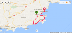
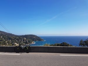
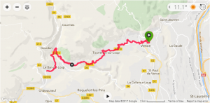
This would be my first time (legally) riding Gatineau Park’s ‘Snow Bike’ trails. Total ride was 2.5hrs, 27km, 1700feet. 27km was a clockwise ‘loop’ including several out & back sections.

GatsFatBiking

There’s been a shift in National Capital Commission’s (NCC) mindset over the past couple of years with regards to bike use in Gatineau Park. Much credit of this new-found access goes to Ottawa Mountain Bike Association (OMBA) for working with NCC.

2016 saw NCC open access to new:

  • Summer trails: “Following discussions with the mountain biking community in the region, the NCC is increasing the mountain biking offer by adding 7.8 kilometers to the shared trail network in Gatineau Park. This is a pilot project (ending on November 30, 2016) on trails 3, 14 and 33 as well as on trail sections 2 and 32.
  • Winter Fat Bike trails: “In addition to snowshoe trails 64, 65, 66 and 67, snow biking will also be allowed on trails 70, 71 and 72, still as a pilot project this winter. The National Capital Commission is responding to the growing demand among snow biking enthusiasts.”

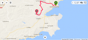
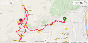
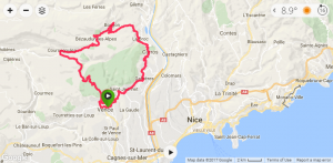
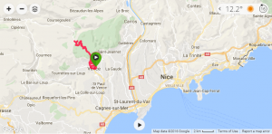
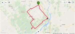
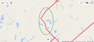
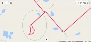
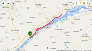
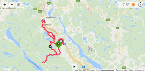
Below is a map to the original 2016 pilot loop which I have yet to try. I’m hoping to ride/document it in the coming weeks as it’s only minutes north of downtown Ottawa.

Gats_LowerLoop

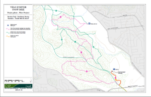
For my first official ride I decided to take the 20 min drive north from Ottawa to try the upper/northern route. I selected this loop in anticipation of lighter traffic on what was a perfect day to be outside.

Gats_UpperLoop

The north loop offers two parking spots (P15 & P17). I opted for P15 because it was about 5 min closer and figured it would be a quieter parking lot than P17 Wakefield (it was).

Gats15

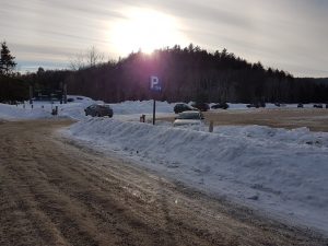
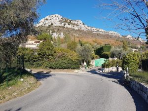
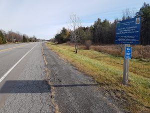
P15 Crossloop parking lot, only a few hundred meters off Highway 5 (take Crossloop exit #24 and drive West over the highway).

Gats1

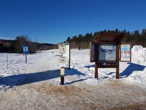
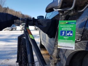
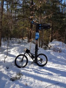
Trailhead and box for trail pass payment, $7.50. Early bird season pass is ~ $50, I’ll be getting one next year. Be sure to have the trail pass visible.

Gats2

Rules & recommendations to Gatineau Fat biking:

Only winter bikes, also known as “fat bikes”, equipped with tires at least 9.4 cm (3.7-in.) wide will be permitted.

  • Required outdoor temperature: 0 °C or less
  • Required depth of snow cover: 5 cm (2 inches) or more
  • Recommended tire pressure: 10 PSI or less
  • Get off the trails:
    • If your tracks are deeper than 2.5 cm (1 inch);
    • If you have trouble steering in a straight line;
    • If you have to walk your bike up small, easy hills.

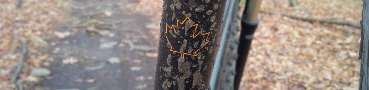
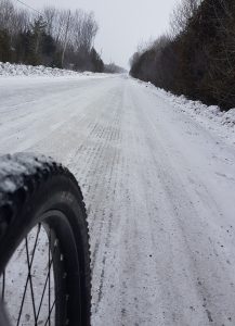
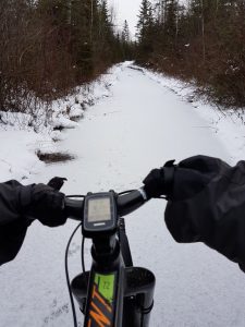
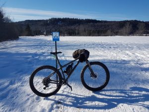
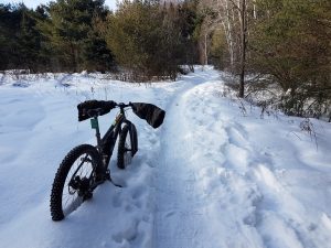
My PLUS bike only has 3″ wide tire which was perfect for all but a short section of the #72 upper loop (challenging but still rideable w/o making 1″ track).

Gats3

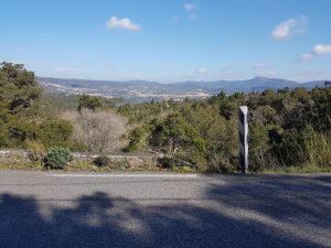
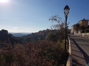
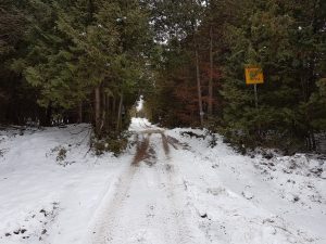
Plenty of signs to direct you along.

Gats4

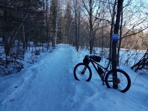
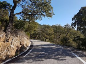
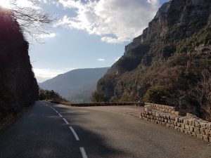
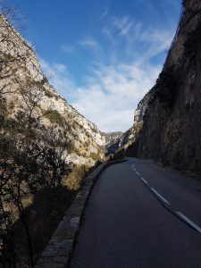
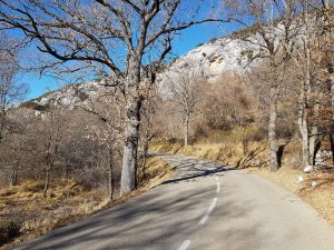
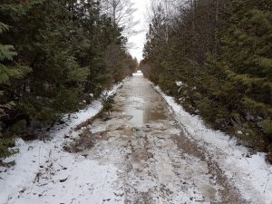
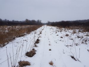
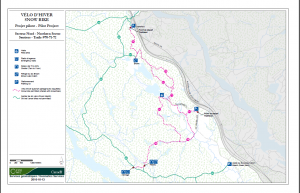
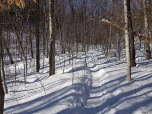
I started in a clockwise format riding #70 to the end. #70 was hard packed, 2-3 track wide trail, and felt like an autobahn. Be mindful around blind corners as there were quite a few snow shoers.

Gats7

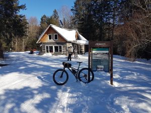
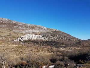
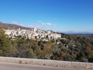
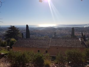
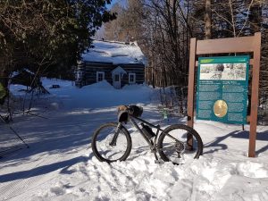
Near the end of the trail you pass Healey lodge. You’re now up with the XC skiers (massively popular). After a short jaunt on a multi purpose ski/snow shoe/Fat bike trail you jump onto narrow single track for ~500 meters.

Gats6

The second lodge, and end of #70, is Herridge lodge. IMO I wouldn’t bother doing that last little part from Healey. The track is too narrow and the traffic too heavy to get any kind of flow. Best to turn back down #70 at Healey lodge. The fun is not over yet!

Gats5

About 1/2 way back down #70 you’ll see #71 heading north/left.

Gats8

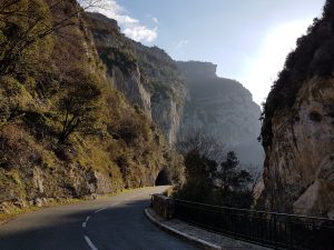
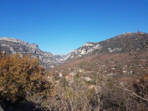
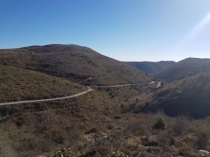
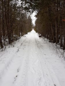
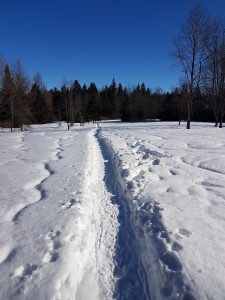
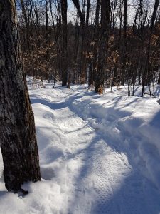
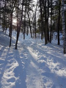
This portion of the trail is pretty damn epic. Single track, fairly hardpacked, and LOTS of ups/downs/turns.

Gats9

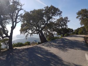
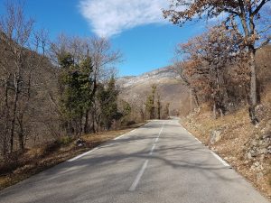
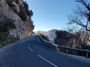
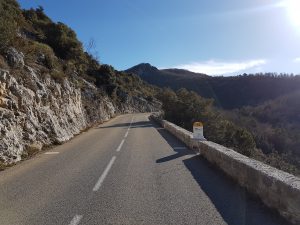
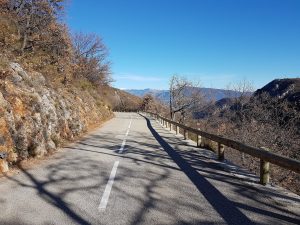
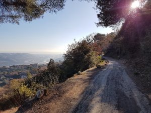
As you ride further north on 71 the climbing/descents get significantly more difficult. These are some more tame pictures.

Gats10

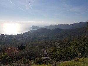
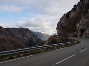
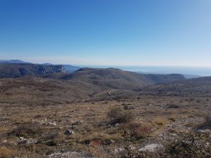
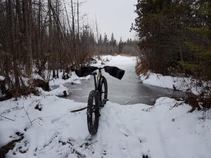
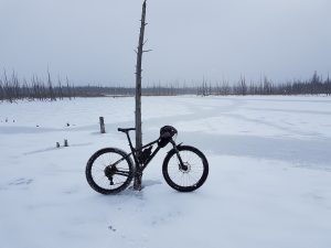
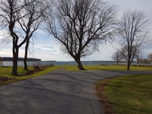
Once you pop out at the lake the technical bit is done (not the climbing though!)

Gats11

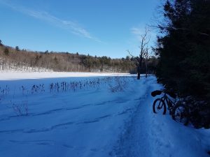
Eventually you join #72 towards the town & parking lot of Wakefield (P17). There appears to be less snowshoe traffic (more Fat Bikes) on this end of the loop so sections were bumpier and/or softer.

Gats12

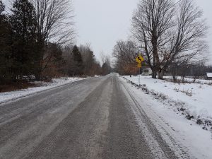
Once you get to the Wakefield parking lot you can ride out a couple hundred meters, through 2 roundabouts & under Hwy 5, to get to Timmies for refueling.

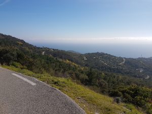
Back on the trail you’re quickly greeted with a grunt of a climb (all rideable). Continue up 72’s north/east clockwise leg and your HR will quickly get pegged with climbing.

Gats13

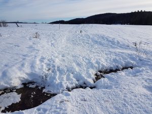
The only thing I’d like to see is some effort from NCC to place temporary wooden bridges over the several creeks that bisected the trail.

Gats14

All in all I was thoroughly impressed with what I rode. This is getting close to caliber of Canmore’s Highline trail in terms of length and epicness.

I’ve always said that if Gats opened up to Fat Biking I would purchase a proper rig. My PLUS rig easily handled these hard packed conditions but a proper >4″ tire will cover a broader range of conditions.


An afterthought on France – why road riding is so much better there than in North America

backhome

Barely 48hrs later I’m back on familiar ground. Today’s long and straight road gave me time to think about the trip, and somewhat ironically helped me realize why I enjoyed riding in France so much.

Back on Dec 28th I posted: “Biking in France is one of my top 3 favorite type/places to bike (Gravel & Fat biking are the other two). It is one of the only places I’ve consistently enjoyed road riding over the years.

Prior to that statement I never really put much thought into why I felt  road riding in France is so much more enjoyable to me than in North America. All I knew is that whenever I came back home I would try to continue road riding but my interest would dwindle after only a few months… On this trip I was determined to find out why.

After careful consideration I believe these observations are the foundation to my love of riding in France:

  • French roads have more elevation changes, are more twisty, and generally less ‘dumbed down’ than in North America. In Canada there tends to be more earth movement, or relocation, to make roads as level and straight (read: boring) as possible.
  • French roads tend to have lower rural speeds. This is likely due to  large population, confined spaces, or the aforementioned snaking roads. I rarely saw zones above 70kph. In Canada we have a LOT of straight roads which allow for 80-90kph limits (read: 100+kph).
  • The French are more patient when behind the wheel of a car. I drove quite a bit on this trip and was quite amazed at how willing everyone was to cooperate for the better of mass movement.

All of this means that road riding in France offers a MUCH more engaging experience without feeling like your safety is compromised. Whether it’s the scenery or constantly changing direction of the road, zoning-out on a ride in France is pretty damn hard to do. Frankly speaking death is not far away if you don’t pay attention over there, in many ways it’s similar to a mountain bike trail at speed. Having said that, safety is much more in your control because drivers are far more patient to pass, if at all (it’s not hard to match/exceed posted speed limits on the frequent descents).

PS: The amazing thing is that despite the positive experience my bike didn’t allow me to maximize the potential on this trip. My Cannondale CAAD10 is old, beaten up, and equipped with tired parts that I could never sell. It’s an awesome bike, but it’s seen a lot of HARD miles, and that’s after I purchased it used from a racer up in Quebec city. I really couldn’t get around to fully trusting my bike (read: brakes) on most of the descents which was a bit of a buzz-kill. Personally I would have LOVED a stiff disc-equipped bike that had clearance for a fat & fast 30mm tubeless tire (Schwalbe S-One). In fact, the new Felt VR4 has caught my eye…

Vence part Cinq

gourdon

Last day in France – I decided to check out the town of Gourdon, a small hamlet perched on a cliff ~1700 feet above the valley floor.

dady5_2

I rode up the Loup Gorge one last time. Amazing scenery.

dady5_1

After 2 weeks the climbing is getting easier. I love to climb regardless, but having a bit more punch makes it that much more fun.

dady5_4

Nothing too scary on the way up. The way down had some eye-opening sections in the first few KMs.

Beautiful view up top, you can apparently see 70km of the Mediterranean coastline from here.

dady5_3

My first stint to France this winter is now a wrap. I had hoped to get 400+km but it just wasn’t possible with family sight seeing day-trips, and ‘lumpiness’ of the region making you earn each kilometer. My 314 kilometers included 21,000 feet which if you consider approximately 1/2 of that was descending, everything else averaged out to approx. 4% gradient. There’s not much that’s flat in this region!

I look forward to coming back in 6 weeks (for another 2.5 weeks!) and checking out St Maxime, France. This second location is closer to the coast should and should have ‘easier’ kilometers. That and going solo will mean I can hammer out a lot more kilometers.


Vence part Quatre

vence75kmloop

After a couple of days off I felt strong enough to try a 75 km/5000 foot loop. The idea was to combine the first portion of day 3 along with a large backwards portion of day 2’s route. Elevation would be gained by riding North up the Gorge de Loup, then East along the a high alpine ridgeline. You can see the un-used Col de Vence bisecting today’s loop.

day4_1

… and climbing is exactly what I got. The main climb started 37minutes into the ride and continued non-stop for 21km, taking me almost exactly 1.5 hours to haul my ass 2700 feet up into the sky.

day4_2

One interesting feature riding at this time of the year is the seemingly changing seasons all within a single ride. The temperature/smells really varied on this loop from fall/winter/spring. Here the air was warm and leaves still dropping & blowing around – similar to a mid/late October ride.

day4_3

Riding up the gorge/canyon was a lot of fun. The grade was manageable and traffic minimal.

day4_4

I’m certain this picture would look totally different in the spring/summer. What looks like brush is actually a lot of trees waiting for spring before budding.

day4_5

Lots of sections were cut into rock and the road build out with concrete.

day4_6

I love those mileage markers, they tell you what road you’re one, the distance to the next town, and present altitude.

day4_7

As I got higher the air naturally got fresher, add the singing birds and it really felt like a late April/early May spring ride.

day4_8

Town of Coursegoules plunked right on the side of the mountain.

day4_9

In the shade the temp dropped >10 degrees and frost was frequent. The risk of black ice was ever-present. Winter had returned until I rode out of that ravine and back into the sun.

day4_10

day4_11

day4_12

The cool hill-top town of Carros.

day4_13

Today’s route even found a few kilometers of gravel! My Cannondale CAAD 10 equipped with 28mm Panaracer Gravel King handled this with ease.

Vence part Trois

day3

With my legs getting a little heavier I decided to ride west for a ‘light’ outing. 40km and 1850 feet later I completed a simple out & back. There was more climbing than expected (hard to NOT climb around here) but at least the pitch was quite shallow which made for fun descents and manageable climbs..

day3_1

Approaching the Medieval town of ‘Tourrettes sur Loup’. Will be checking it out on foot tomorrow.

day3_2

Backside of ‘Tourrettes sur Loup’

day3_3

There are a few of these old rail bridges in the area. Similar to North America they’re converting these lines to rail-trails.

day3_4

My route took me to the bottom of that gorge, the cliffs were quite impressive! This area is very popular for hand gliding etc…

day3_5

Another beautiful 15 degree C day. It really feels like late September/early October here, with the sun setting quickly but still relatively warm. Some trees are changing color and dropping leaves.

Vence part Deux

day2

With jet lag a thing of the past I looked to make a longer ride. I managed to put together a nice 55km loop with 4000 feet of climbing and ending with a blast down Col de Vence

55kmloop_1

This picture gives an accurate reflection of the land/homes in the region surrounding Vence.

55kmloop_2

There are quite a few mini hamlets perched on top of many peaks in the region. St Paul de Vence is a world-famous location, but there’s a lot of other less-touristy sites to explore as well. I believe this is the town of ‘Carros’.

55kmloop_3

One thing they all have in common (besides difficult to invade) is their amazing view. I believe this is the town of Le Broc.

55kmloop_4

Great views like this make the climbs go super fast.

55kmloop_5

Despite being this far south, temps can drop below 0 overnight leaving potential icy spots on the road. There’s a good 10 degree difference in the shade versus in the sun.

55kmloop_6

Town of Bouyon in the distance.

55kmloop_7

After a fun couple of hours I was rewarded with a blast down Col de Vence. This being my 2nd (and not last) time I’m letting the bike roll a little more knowing there’s few tight turns to worry about.

55kmloop_8

OttawaVelo goes to Vence, France for the holidays

vencemap

Biking in France is one of my top 3 favorite type/places to bike (Gravel & Fat biking are the other two). It is one of the only places I’ve consistently enjoyed road riding over the years.

coldevence_1

My love for riding in France is the combination of familiar language, challenging terrain, incredible views, amazing culture, and respectful drivers that really add up to an awesome experience.

coldevence_2

Within a kilometer of my accommodations for the next two weeks is a great climb called Col De Vence. Bonus!

coldevence_3

This climb is a little over 2000 feet in just over 9km, making a nice medium grade of ~7%. My 42;32 1×10 gearing was *just* enough to handle this climb. Despite the gearing, it’s the (lack of) cardio that ends up being the limiter for me – sustained climbing fitness is not easy to acquire when in Eastern Ontario, especially during the winter months.

coldevence_4

Soon this Col brought me into the open terrain that was littered with small rocks. Pavement had few cracks/potholes and the finish was a smooth chip-seal.

coldevence_5

Once high enough you can get a really good feel for the layout of the land, where Southern Europe meets the Mediterranean.

coldevence_6

Just to the North you can see the pre-Alps.

coldevence_7

This was a really nice climb. The descent down was really quite manageable with no surprise corners and a reasonable pitch that kept speeds from being too crazy.

Winter Gravel – Giving Marlborough another go

wg_map

Winter brings a nice new dynamic to riding in general. Fat biking is probably my most favorite type of riding so I’m anxiously waiting for the snow to arrive & pack.

In the meantime, gravel is still good and offers a nice change to the scenery.

wg_1

Partly through my usual weekend loop I decided to deviate and (naively?) see what Marlboro had to offer.

wg_marlborough_1

With limited snow and frozen conditions I figured this would be as good at it gets for the year (apart from late summer when it’s dry and mosquitos are limited).

wg_2

The first part of the trail had some freshly broken ice. The ATVs were out in force making sure this soon-to-be skidoo trail was well marked. While there was a LOT of water in Marlboro, this was the most difficult passage.

wg_3

Pretty much all of the other parts of the forest were frozen over.

wg_4

Shiny & smooth = bad! Frosty & white = smooth sailing.

wg_6

After a bit I popped back out onto a familiar section of gravel.

wg_9

The gravel didn’t last long, continuing on my adventurous theme I was back in forest within a kilometer.

wg_marlborough_2

This southern portion was quite a bit drier, or at least the routes leveraged higher lines.

wg_5

Having said that, there were a couple of big ponds back there.

wg_7

The last part of my loop I took an unmaintained road which ‘connects’ Paden Road to McMullen road – effectively bypassing Cowell Rd. Despite the favorable frozen conditions this route was pretty slow and not something I’ll be adding to my future rides.

wg_8

All this exploration was nice to see but NOT something I recommend adding to rides in this region. It’s pretty safe to say that Marlboro Forest should not be included in any gravel rides regardless of the time of year.

St Lawrence – Cardinal/Iroquois/Morrisburg

I don’t normally head to the St Lawrence area to ride. As my buddy Pete in Brockville told me, you’re limited with only 3 directions to ride, East, West, and North.

map

My son had a hockey tournament in Cardinal Ontario this past weekend and typically there’s a 3-4hr gap between games. A perfect opportunity to explore the region. My usual process of combing ‘RideWithGPS‘ and ‘MapMyRide‘ revealed little in the area (although Cornwall showed some interesting future-visit-worthy potential). A quick comb through Google Maps street view showed little gravel that was safe to access or build a loop with. The best I came across was the main route along the river (Hwy 2) had a paved shoulder for a long way. So a boring, all-pavement out & back it is.

20161112_112859

Thankfully the shoulder was in reasonable condition along Hwy 2. However, there were one or two spots where it disappeared for a few km. One neat part along the route were the multiple plaques which referenced key locations of the War of 1812.

20161112_123646

I quickly figured out I should follow signs indicating ‘Waterfront Trail’. The trail/signs often take you off of Hwy 2 and use quaint little side roads to further distance riders from heavy traffic and closer to the water.

20161112_111246

The Waterfront Trail uses paved roads, gravel, and bike paths. Apparently further east of my route there’s something like 70+km of recreational paths.

20161112_122911

The neat thing I keep reminding myself if just how close we are to the NY border. Just over there is the good ‘ol USA.

20161112_122204

I’ll be honest, I always find pavement-only out & back routes pretty boring. Add the hellacious wind typical of large bodies of water on my way back (I was pedaling at only 15kph at times!) and this is not a route I’m anxiously looking forward to doing again. Still, some of the towns were neat to pedal through. This location wins the creepy haunted house of the day award.

20161112_123107