Almonte MTB trails

AlmonteMap

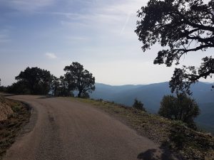
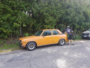
A couple of weekends ago I decided to head out with my son & 510 for a nice drive to Lanark / Almonte region. There were postings of a new trail network and it read as a nice short’ish setup – perfect for younger riders.

Companion

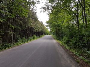
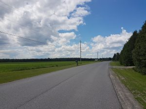
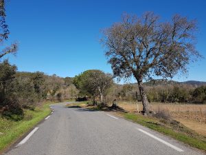
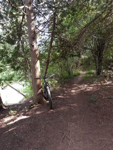
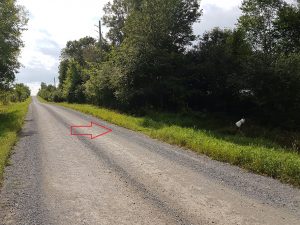
All in all, the ride did not disappoint. The trailhead is small but if you take Hwy 29 NE out of town and then a quick right onto Strathburn Street at the edge of town you’ll see the trailhead on your left.

TrailHead

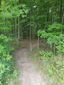
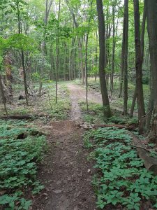
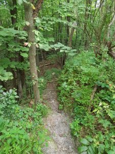
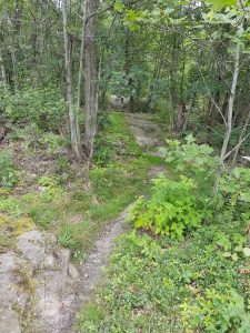
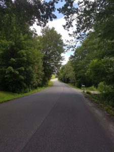
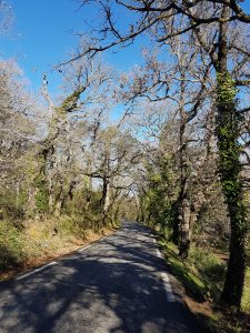
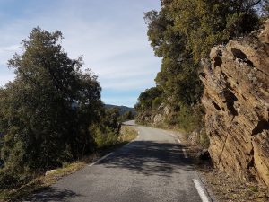
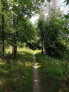
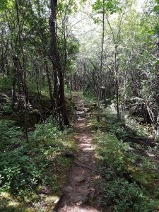
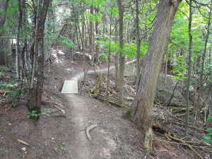
The first part is nice trail as you work your through a few properties enroute to the river.

Almonte1 Almonte4

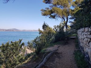
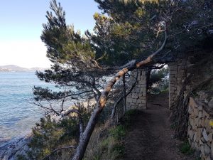
Once at the Mississippi river (no, not the same one in the US) you follow it for a bit before heading back out of the valley.

Almonte3

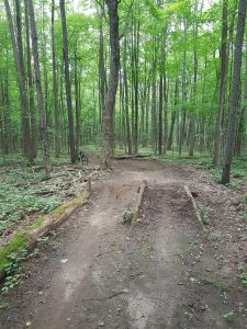
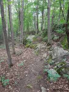
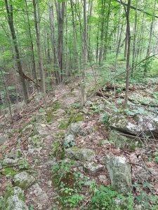
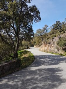
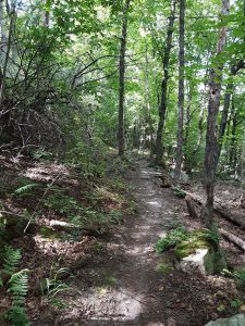
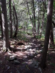
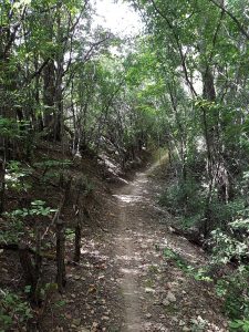
This is where the trail character takes a turn and becomes quite chunky with loose rocks etc. Similar to Rock Hopper in KL.

Almonte2 Almonte5

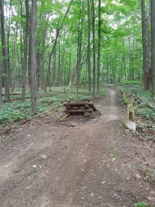
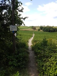
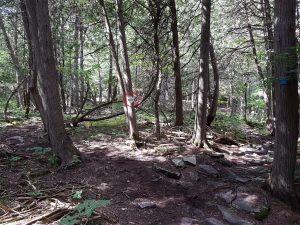
There are several off-shoot loops which are well marked on local signs (one tip painted blue to show the main trail, another tip is black from some extra rock if you so choose).

Almonte6

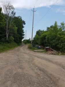
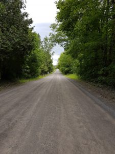
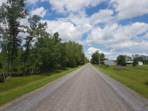
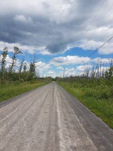
Eventually you pop out into a field and then a gravel road. This is a connector to another fun section and is well worth the 2-3 min effort to get there. You roll down into a small valley and before climbing out keep an eye out for a small trailhead on your right.

Almonte7

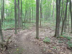
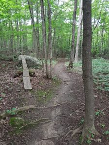
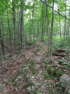
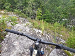
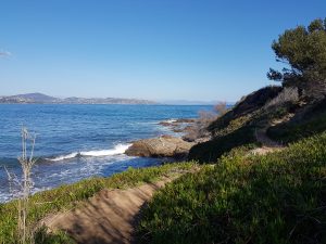
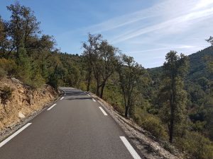
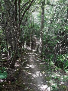
Here the character changes again and the trail works along a ravine. It’s super fun , much like a roller coaster. The trail is well built w/o surprises so you can let the bike roll here – keep in mind there are a couple of tighter but manageable spots.

Almonte8 Almonte9

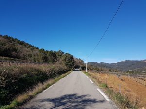
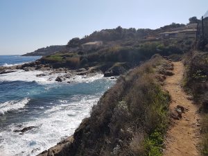
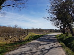
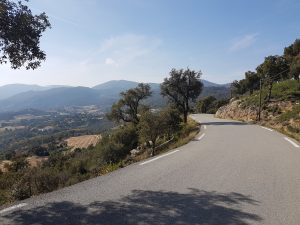
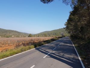
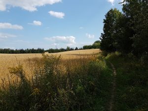
Occasionally the trail pops up & out onto a field. The wheat was fully gown and with the light & weather on that day, it was beautiful. Almonte10

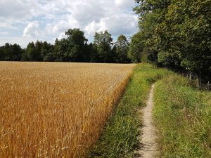
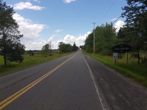
This field -> ravine repeats a few times until you’re back onto Hwy 29.

Almonte11

Almonte12

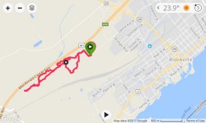
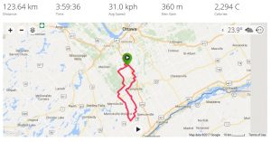
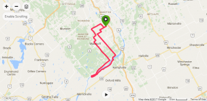
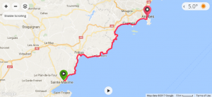
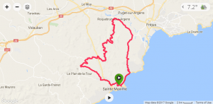
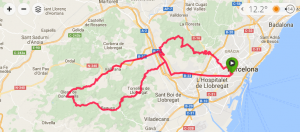
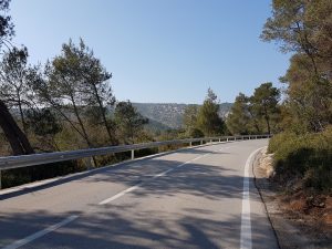
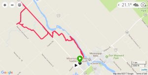
The trail does continue on the other side of Hwy 29 but I wouldn’t recommend it until the locals get better signage & access. As you can see on my GPS map above, we did attempt it but got lost (going wayyy too far down Hwy 29). The crossing is only a couple hundred meters down the road after a guardrail. Much of the back portion felt like mileage-adder rather than can’t-miss single track.

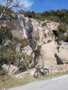
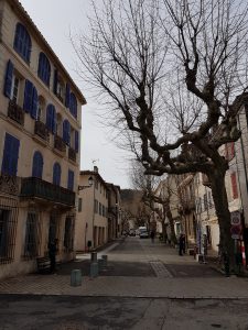
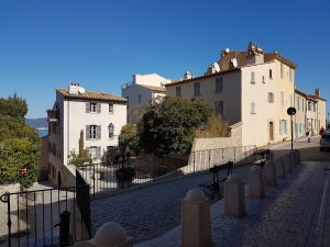
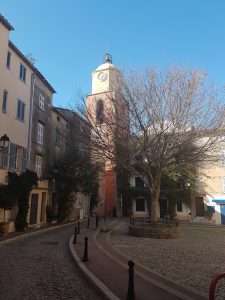
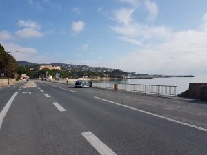
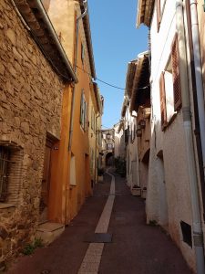
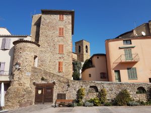
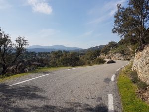
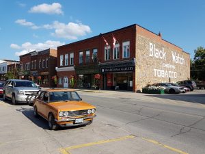
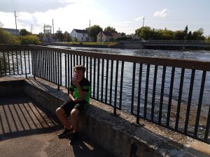
Before heading home I recommend you check out the town of Almonte if you haven’t already done so. It’s a pretty old-town setup right beside the Mississippi river.

StopInTown

I’ve been told the ice cream is too bad either, especially after 1.5hrs and close to 20km.

IceCream

Overall I was really impressed with what the locals accomplished, both in private land access and quality of trail. There’s definitely lots of untapped potential in the back portion so I’m optimistic this network will continue to grow.


Finally a MTB report! BrockTel – Brockville

Map

Last week I had a work related day-trip down the 410, so I thought it would be a good opportunity to squeeze in a light ride on the way home and test my new fork (Rock Shox Yari). Brocktel (aka Black & Decker trails) seemed like a good spot for me to visit. It’s literally meters from the 401 and offers a good range of terrain to see what my fork can do.

Brocktel is a bit of a curious spot. It’s local to several of my MTB friends who are all very skilled riders, who have visited many other riding centers, and overall are quite knowledgeable when it comes to trail design etc… That’s what makes Brocktel somewhat confusing, because from a visitor’s perspective it’s quite a mess in there.

20170803_143047

This trail network makes zero effort to be newbie or visitor friendly. There’s no signs to direct you to, or within, the trails. Case in point, you have to ignore all the chewed up ATV trails that greet you at the dead end of Central Ave W road and instead turn right up this gravel incline to find the single track entrance on the left. It’s not a bad thing per se, just keep in mind that the scope of this network is focused on local enjoyment only.

20170803_143220

Once you do find the single track, the first several hundred meters are promising.

20170803_151707

There’s flowy hardpack trail, complete with well designed jumps.

20170803_151839 20170803_151824

After just a minute of two I spotted my main (and unfortunately ubiquitous) pet peeve of many trail networks I visit, unmarked & seemingly random offshoots which distract you from enjoying the trail/jumps.

20170803_151925 20170803_143806

This first part of the trail has a nice light downhill gradient to keep the speed, quite a bit of effort has been put into the trails here and it’s nice.

Eventually you start to climb back up and are dumped out into an unmarked intersection where the effort in trail design/maintenance takes a noticeable turn.

At this point you could play Tonto and start scrutinizing the dirt for tell-tale signs of tire tracks, or take a guess and choose a direction. Based on my memory from riding here with locals last year I knew to turn left then first right (after some exploring I discovered you could turn right then left to complete a loop and maintain the ride’s difficulty to blue/medium).

20170803_143924

Quickly the terrain changes and so does the difficulty. The trail becomes much more… natural. You start to see the true mindset of what the locals enjoy for technicality. While they (we) are all aging they are still not afraid to challenge themselves.

20170803_144015

This part of the trail becomes slow, tight, somewhat overgrown, and the stability/footing of these rocks are questionable. Unfortunately, the word ‘sketchy’ works its way to the front of my mind. Start paying attention or it can go south quickly…

20170803_144027

The further you go in, the more confused you become with the dozens of forks, and aware that it’s just a matter of time before you:

  1. Smash your bike on some stupid shit which really didn’t need to be that sketchy to be difficult
  2. Donate blood, either in a crash or to the thousands of mosquitos who easily keep up due to the tightness/slowness of the trail, or
  3. Look for an easy way to bail and maybe salvage enough of your afternoon to enjoy a beer on your deck instead.

20170803_144158

Yeah, my assessment is harsh, and yes I’m getting to be an old fart. While I can ride this terrain, I honestly don’t enjoy doing so. Technical is not fun when there’s seemingly an element of luck that’s preventing you or your bike from harm. I’d rather ride technical that’s well built with limited & consistent variables so that (reasonably) repeatable results will occur if you choose to challenge yourself.

20170803_145031

Every now and then the trail pops out onto exposed Canadian Shield offering yet another type of terrain. This stuff would be super fun to leverage if there weren’t so many damn forks every 50 meters or so.

The pic below shows just how close the 401 is to this trail network (just to the right side of the pic).

20170803_144924

And that’s it. My 5km ride proves that I selected option #3 above. From past rides with locals I know there’s more sketch out there but after several dead-ends and bail-outs into ATV mud bogs, I lost the patience to waste my time searching when it could (should?) have been easy for signage to show me the way. I’m here to ride, not explore.

This review is NOT about the local riders. This area is frequented by many users, ATVs & 4x4s have had a notorious history of chewing up the trail around here. The damage caused by others is not hard to miss. However, what confuses me is that there are clearly sections that are used exclusively by MTBers but there’s seemingly little done to maintain. Several spots could have used some simple wooden bridges, overgrowth clearing, and just some basic armouring. Hell, even spray paint color coded dots on the trees to outline some kind of loop.

… and maybe that’s the whole point of this network. It’s ridden by locals who only want to cater to locals. Either way, it’s certainly unique and definitely has some fun buried in there for the riders with the right mindset. Just be prepared to invest quite a bit of time to learn the area first.


Still here!

I recently went to a friend’s B-Day party (75!), and being a fan of this site, he proceeded to give me shit about not updating this blog. So Denis, this posting is for you. 🙂

BigLoop

Now, I do have an excuse, two actually. As previously mentioned I’ve been training for a 50km run this August. That’s taken up a lot of my would-be cycling time. Secondly, and probably more impactful, is the absolute shitty weather we’ve have this spring/summer. We’ve literally smashed previous records for April, May, and June was no better. We’re now 17 days into July and we have had a grand total of 2 days in a row w/o rain.

Fields everywhere are flooded, seriously impacting crops. Farmers are struggling to cope with the water, below is one example where a tractor was hooked up to a pump and was launching water close to 30 feet across the road.

20170626_143357

With this upcoming 50km trail run I’ve had to focus on rides of 4-5hrs in length to build my cardio. It occurred to me that I’ve never put a 100+ km loop to the south of the city, so off to Google maps I went and found a really nice route (Davis Road off Burrits Rapids Road) to branch further south from my typical Burritt’s Rapids loop.

20170626_131155

Davis Road (pictured above & below) is a really nice tranquil chip sealed road that happens to connect up to some really sweet gravel to the south.

20170703_134228

20170626_132140_001

20170703_140428  20170703_142312

Follow the gravel far enough south and you start get into some exposed terrain, similar to Lanark Highlands.

20170703_143729

Eventually I got far enough south to ride through Limerick Forest, a popular MTB and dirt bike conservation area in the spring & fall where the ample sand absorbs and packs down with rain – although even this area was recently flooded with all the rain

20170703_143911

I decided to post the somewhat boring picture below because literally a second after taking it I realized there was a LARGE German Sheppard right on my derailleur. It wasn’t easy to accelerate with one hand on my phone (no time to stuff into my back pocket) and another hand on the bars!

20170703_144154

After Limerick the route turns North again through Oxford Township and the really pretty town of Oxford Mills (sorry, no pics of the town itself).

20170703_145056

20170703_145832

20170703_150324

Eventually the loop connects back onto River Road a few kms East of Burrits Rapids.

20170703_133829

This monster loop was 123km long, of which 75km (61%) was gravel! The rest was quiet country roads and/or a lined biking shoulder. Super safe route overall.

Probably more satisfying than discovering this great new loop was that that I managed to finish in under 4 hours which = +30kph solo average (w/o any breaks) – a good sign that my fitness is reasonable for my upcoming run.

Burritts (Rapids) Loop, Hutchinson Sector 32 review

First post, and frankly meaningful ride, since coming back from France. Weather has been shit to say the least, so when the forecast showed +5 and ~10kph winds, I seized the opportunity to take my Redline out for the first time in nearly 5 months.

RedlineSpin

Despite punching out a stiff gravel run the day before I decided to ride one of my favorite loops through Burrits Rapids. Total ride was 69 km at a steady 2.5hrs.

BurritsLoop

The route was slightly modified to cut about 15km of thawing/soft gravel along Paden/Harnett road. Typically it’s a FAR better option than the busy/shoulderless Donnelly Drive running along the northern portion of Rideau River.

PadenGravel

Riding across the Rideau River near Kemptville. As you can see we’re still well inside winter up here…

RideauRiver

Part of the historical Rideau Locks near Burritts Rapids dating back to circa 1832. After being in France for most of this winter, that’s not really old, but standards have to be reset back in North America. 😉

RideauLocks

This is a cool swing-bridge located in Burrits Rapids. In the summer you can see this in action, operated manually by a single individual.

BurrittsBridge

Back to my Redline, I forgot just how nice this bike rode. I’m sure the new Hutchinson Sector 32c tubeless tires contributed to the sense of speed & ride.

While quite narrow (31.7mm on a wide Pacenti SL23 v2 rim) they’re almost 100gr lighter than the larger (too large for my Redline) 35c Schwalbe G-One. The Sector’s rode super smooth & quiet on pavement and felt a good 2-3kph quicker than last year’s G-One. These tires are getting damn close to entry/intermediate road slicks IMO, I wouldn’t hesitate to take them with confidence on a fast roadie group ride. They’re possibly even a bit faster than the 28c Panaracer Gravel King slicks (w/latex tubes) I rode in France all winter. Where the Sectors gain in speed they lose a bit on rough gravel – understandable given the difference in volume.

With 1 scoop (~60gr) per tire of Hutchinson’s own Protect’air sealant, the Sectors aired up tubeless relatively quick (pre-stretched them for a couple of days w/tubes). I rode them at 50/55 psi (f/r) and it was just about perfect with no out-of-saddle pavement slop but still enough gravel cush. I’ve lost close to 20lbs since the New Year so my normal tire pressures will have to be reset a bit going forward.

They look to be a great tire to handle a bit more pavement/climbing duty than some of the more burly gravel offerings. I’m curious to see how durable they end up being. Depending on durability and riding tastes I might try Clement Strada USH next.

Sector32

With regards to new route postings, that will be it for awhile. I plan to commit more hours to trail/gravel running for a 50km race this fall. I’ll still document new bike routes but I don’t expect to do a whole lot of gravel exploring this summer.

In the meantime, I’ll take some time to load up pics from the archives – the rides before OttawaVelo came to be. Stay tuned, there’s some amazing stuff from all across the country!


France part Deux – Saint Maxime to Collobrieres & back

One last go before I pack up. I found what looked to be an interesting route so I held off on packing the bike until after the ride – and right before I left St-Maxime for home.

CollobrieresMap

My ride to Collobrieres would be an out & back, 82.3km, 5140 feet. As this would be my last outing in France, I emptied the tank – which was a nice change from the typical 70-80% cruising (in order to survive 2.5 weeks of daily activity).

20170305_091955

Being Sunday, the main coastal road was a little quieter. I’m not sure if it’s the cause or effect, but there’s a ton more roadies out on Sunday.

20170305_095534

This ride was a little more… green. The day before there was a ton of rain and near 100 kph winds (still 25-40kph on this outing). That precipitation seemed to have an almost instant effect to the vegetation.

20170305_095653

All the locals took the opportunity to enjoy what was a beautiful early spring day.

20170305_100334

20170305_100534

The climb up to Collobrieres was a really nice sustained gradient. It felt good to put some sustained torque through those pedals.

20170305_101843

As usual, the excellent French regional road signs let me know where I was and how far to my destination.

20170305_102127

20170305_102213

Near the summit I was surprised to see a perfect view down to the Golf of Tropez. The town of St-Tropez can be seen on the right side of the bay.

20170305_103251

After yesterday’s rain, lots of water was coming down the mountain. A few sections had sand & gravel run-off as well.

20170305_105125

20170305_104507

This region is known for their cork trees. Apparently the bark can be removed w/o hurting the tree.

20170305_110945

Collobrieres was a nice little quite town. Given the high standard of France, there was nothing fancy here – but it would easily be a tourist hotspot back in Ontario.

20170305_111613

Main square was busy.

20170305_111718

Back to the town that’s hosted me for nearly 20 days. Saint Maxime is such a different setup than Vence, it definitely has less history and more money, but it’s just as cool. That’s the amazing thing about France, you don’t have to go far to get a different vibe.

20170305_125216

All in all, it was an awesome trip, and a great way to spend a winter! I covered 470 km on this trip (including Spain) for a total of approximately 800 km. Not once during the ~50 hours I spent on these roads in France and Spain did I feel endangered. Drivers were respectful and patient. It’s a shame the same can’t be said for North America.


France part Deux – Le Sentier du Littoral

In an OttawaVelo first, and possibly not last, I’ll be posting some pictures of my trail run (16km out & back) along the famous coastal trail from St Tropez.

SentierLittoralMap

Translated to English, Le Sentier du Littoral means ‘Costal path trail’, in this case around Cape St-Tropez. St-Tropez started once as a small fishing village. It soon became famous with artists and jet-setters to eventually become a bit of a ritz-y village.

20170225_111701

The trail starts after the cemetery located below the citadel.

20170225_113128

20170225_143414

The first portion starts along beaches of the Mediterranean sea

20170225_114914

20170225_120804

Eventually the trail works it’s way between million dollar mansions and the coast line.

20170225_120812

Being a MTBer at heart it’s easy to wonder if this trail is feasible by bike. While there were no signs indicating they weren’t allowed, common sense would quickly show that it’s not feasible. There were several obstacle-like portions along jagged rocks & elevated sections that I would hesitate to put any children through.

20170225_120833

Eventually it’s rounds the cape and the terrain becomes a little more raw. Wind and swells also increase as we leave the Golf of St-Tropez.

20170225_121210

20170225_121550

20170225_123002

Eventually the trail crosses a few beautiful but somewhat raw beaches. I didn’t bother with pictures as there were a few local women who apparently found it quite warm that day.

20170225_124210

Whenever the beaches ended the trail continued along some beautiful shoreline.

20170225_125631

20170225_125634

Running out of legs, and time, I turned back at what I believe was ‘Tiki beach’. Had I had some means of a lift back to St-Tropez I would have continued down along the coast for another 5-10 km.

France part Deux – Vidauban Loop

This will likely be my last postings of this trip. I’ve covered just about every angle from St Maxime, and combined with heavy legs from trail running, my plans for additional long rides are pretty much done.

VidaubanLoop

Today’s trip took me 68km and 3,500 feet. It was also the first day I’ve experienced southern France’s infamous ‘Mistral’ winds, which were coming from the North West at about 25kph clip (gusting close to 40kph). I chose to ride clockwise and use the long decent to Vidauban to offset the headwind.

Here’s my view every time I head out the door.

20170301_103342

Once again, lots of cycling-specific lanes.

20170301_105335

The area is quite dry and warm, as confirmed by the plenty of cactus and what appear to be giant aloe vera plants.

20170301_112133

This route didn’t disappoint, there were plenty of beautiful twisty & quiet roads. Lots of cyclists were out doing the same, including some younger organized teams (complete with team car).

20170301_113506

20170301_124909

Lovely quiet roads along vineyards.

20170301_122422

France part Deux -75km along the Riviera up to Antibes

My folks were going to Antibes for the day so I decided to ride out and hitch a lift back. It was a 73km ride with a somewhat surprising 2500 feet of climbing.

RivieraMap

It was a beautiful day yesterday. Little wind (most of which was a tail) and being Sunday the roads were light in traffic and plenty of cyclists.

20170226_090844

The terrain was varied, ranging from wide & flat marshy areas right to sea-side hills towering close to 1000 feet.

20170226_091425

Every town had a quaint little harbor. Despite this region being popular with tourists, many of these smaller towns were still working as they were for the past decades.

20170226_092731

Where there wasn’t a harbor, or expensive real estate, there were pristine beaches.

20170226_092815

Being Sunday, several towns had their market in full swing. This one was several kilometers long!

20170226_093339

The closer to Cannes, the lumpier the terrain became. This picture didn’t do the redness of the rock justice.

20170226_095346

20170226_100834(0)

Amazing view with the snow-capped Alpes in the distance.

20170226_101547

20170226_103424

Once in the outskirts of Cannes, the main road along the beach was closed to traffic. It was packed with runners, families, roller blader’s, and cyclists.

20170226_110314

Some of the amazing beaches around Cannes, this is looking back South-West at the terrain I just rode.

20170226_111140

Cannes was certainly busier than my previous trip in January.

20170226_111244

Shortly after Cannes I arrived in Antibes. I was surprised just how nice it was. Smaller and a little less glitzier than Cannes, there was no shortage of views and history.

20170226_111500

Another market in the heart of Antibes.

20170226_121343

Beautiful wall lining town. Makes you wonder if it was ever put in use to keep the baddies away…

20170226_121602

20170226_144707


France part Deux – Tour around St-Maxime & Roquebrune Sur Argens

After a tough day of trail running yesterday I wanted to do a shorter ‘spin’ around St-Maxime. Despite heavy legs, I managed a 59km ride with 3800 feet of climbing.

Maxime_Tour_2

The route start along the Mediterranean Sea. Despite the view, the road can be quite busy/noisy/stinky (LOTS of diesels in Europe!).

20170223_110405

After a short ride along the water I veered north into the hills.

20170223_111021

Despite having some amazing road riding in this area, Mountain biking seems to be nearly as popular around here. There’s a spot in St-Maxime and ‘Azur Bike Park‘ a little further east.

20170223_111623

The start of this ride was along some open, somewhat boring roads. Nice biking shoulders as usual. It’s not really needed at this time of year, but during the summer months this region apparently becomes insanely busy.

20170223_112813

Approaching the town of Roquebrune Sur Argens. In the distance the “Rocher de Roquebrune with it’s distinctive red hue.

20170223_113631

Oldest part of this village dates back to 983 but there are apparently signs of pre-history “Bouverian culture” in nearby caves. I LOVE the tiny streets of these Medieval towns.

20170223_114225

What’s left of the town’s defense walls – destroyed in 1592/3 by Duke D’Epernon’s troops.

20170223_114637

Soon I turned onto yet another quiet forestry road. Neat to see some of the old bridges still intact.

20170223_115921

The Mimosa trees were in full bloom.

20170223_120748

Climbing higher into the park. This road skirted the edge of the valleys while maintaining a very consistent grade for close to 10km.

20170223_123730

20170223_122148

Near the top the grade simply reversed, offering kilometers of easy coasting.

20170223_123756

Eventually I turned onto some quiet local farming/vineyard roads. You couldn’t build more beautiful cycling roads if you tried!

20170223_131957

20170223_133153

20170223_133557

France part Deux – Barcelona, Spain!

I’ve never been to Spain, and this trip was my chance to finally visit Barcelona and add this country to my list of places ridden.

Map

When searching which route to take I did my usual MapMyRide, Strava, RideWithGPS sites. Most of the ‘epic’ routes recommended climbing the mounting overseeing the city to the west, and the gravel climb up to Begues. This would be a 82.82km ride with 5,500 feet.

20170220_102344

First off, Barcelona is a GREAT cycling city! Lots of designated lanes in the main (and massive!) Boulevards and side roads.

20170220_102824

Separate lanes, complete with bike traffic lights.

20170220_102920

In no time I was climbing the mountain butting up to the West of the city. As beautiful as it was, pollution was evidentially visible (and could be smelled within the city itself).

20170220_105828

Further up the climb there were several signs reminding motorists to respect a cyclists space when passing.

20170220_111053

20170220_111317

Once you crest the summit, there’s a bit of a decent and then you climb for a bit more.

20170220_112302

Eventually I rode a nice decent (no surprises, open’ish turns and nice pavement w/o crazy grades). I crossed the valley and a fairly industrial region to start climbing the next mountain further to the West.

20170220_124246

My route took me through a national/regional park. The roads were wider than the one I experienced in France, but traffic was still minimal.

20170220_130855

Several quiet roads where included in this route. Nice to see some Spanish vineyards.

20170220_132206

While I didn’t really enjoy the day’s route (too much of it was urban/industrial), I really appreciated the accepting culture towards to cyclists. I felt just as safe biking in Spain as France.